Thank you for the widespread and ongoing community support I've received over the last two decades for my community weather station in schools initiative. Effective immediately, the network will no longer be maintained. Thanks to those continuing to support access to historical data.
School-Based Weather Station Network
Vancouver Island
Stations in the Network
PASS-Woodwinds Alternate School
|
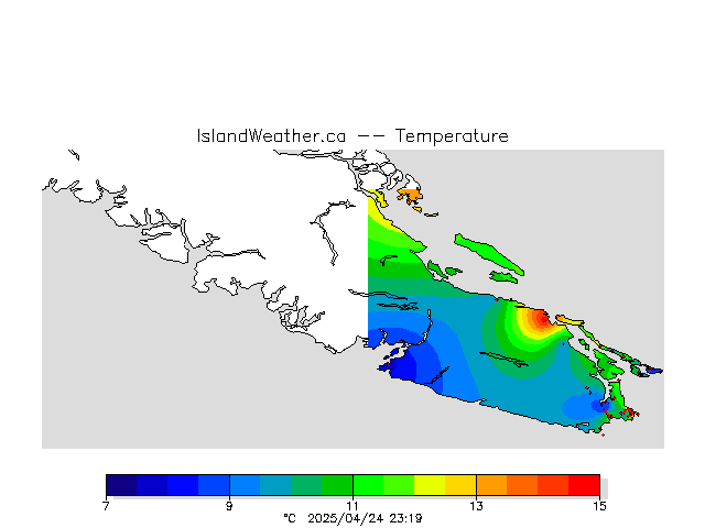
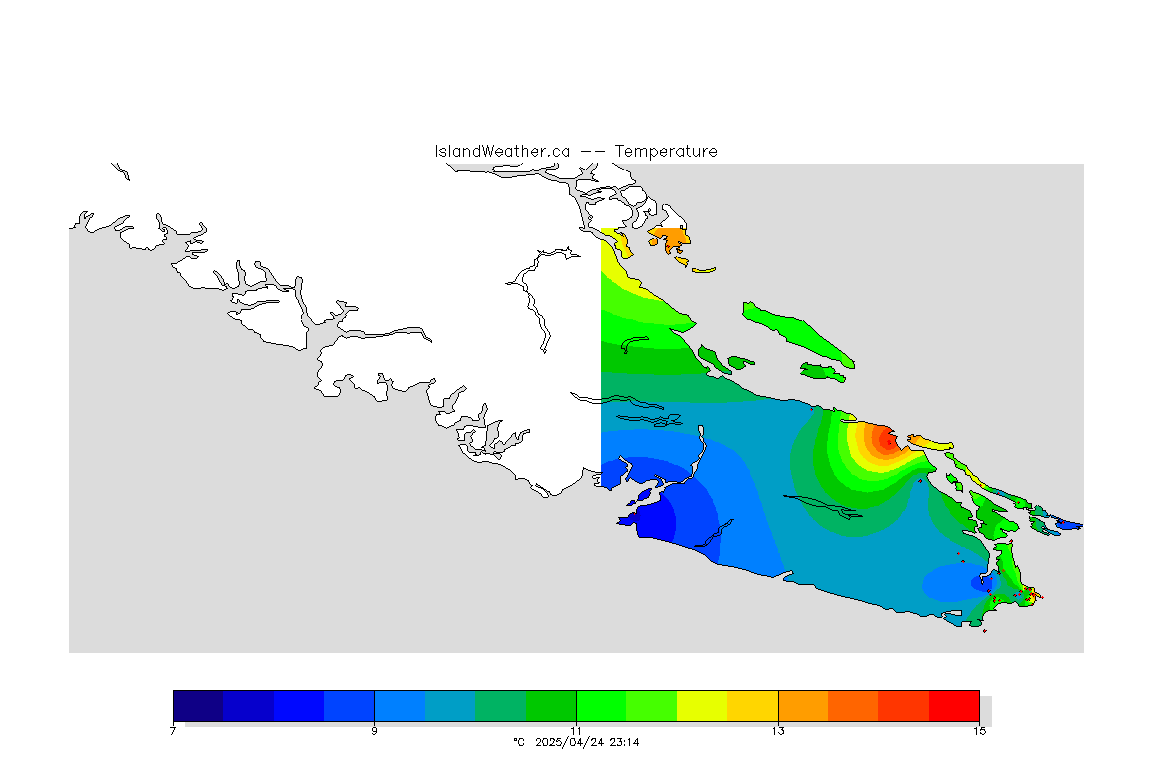
All Stations, One VariableSee plots for a single variable at all of the stations in the network. Summary of Recent ObservationsSee a graphical summary of the latest observations across the entire network. Now storing at least 12 427 636 226 observations.Forest fire danger class rating |
Contact information
For further information or data inquiries please contact Ed Wiebe at ecwiebe at uvic.ca. If you find a problem or have a question about the site please be sure to send the relevant site and page address (the URL from your browser's address bar). Also include a screen capture image if you can so that we can see what you are seeing.

